blah blah blah
Square Ledge
Length: 9.1 mile loopDifficulty (click for info): Very Hard
Elevation Gain: 1750 feet
Rating (click for info): 6/10
Elevation: 2620'
Prominence: 40'
Driving Directions:
Trailhead and parking area are located in Albany, NH. The parking area is located at a short side road on the south side of the Kancamagus Highway, 13.4 miles west of Rt. 16 in Conway and 22.2 miles east of Exit 32 off Rt. 93 in Lincoln. It is located just east of the Passaconaway Campground and just west of the Jigger Johnson Campground.
About the Hike:
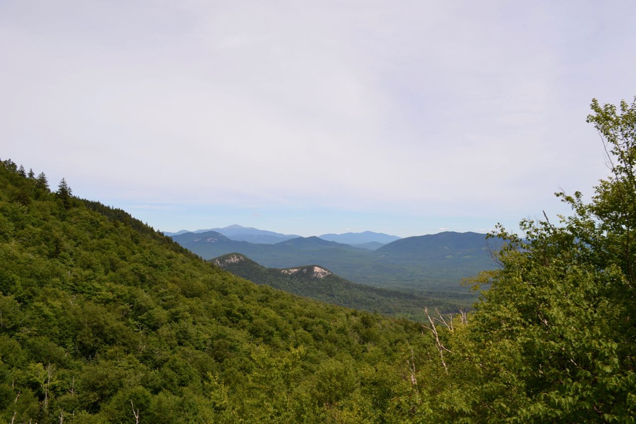
Square Ledge was formerly most noted for its inclusion on the 52-with-a-view list, but was dropped from the list in the 2020 revision due to diminished views. A few viewpoints around the ledge do offer restricted, but interesting perspectives from the Sandwich Range Wilderness. One thing Square Ledge does offer is solitude - the trails in this area of the Sandwich Range Wilderness usually see less traffic than other areas. For the nine-mile loop journey, you will explore various environments which offer compensation for the limited views. The flat, mellow brook walk into the wilderness is nice, as is the experience of hiking up the rugged terrain around the cliff which makes Square Ledge. You can also find some slightly better views from other points nearby to the "standard" viewpoint that many hikers miss.
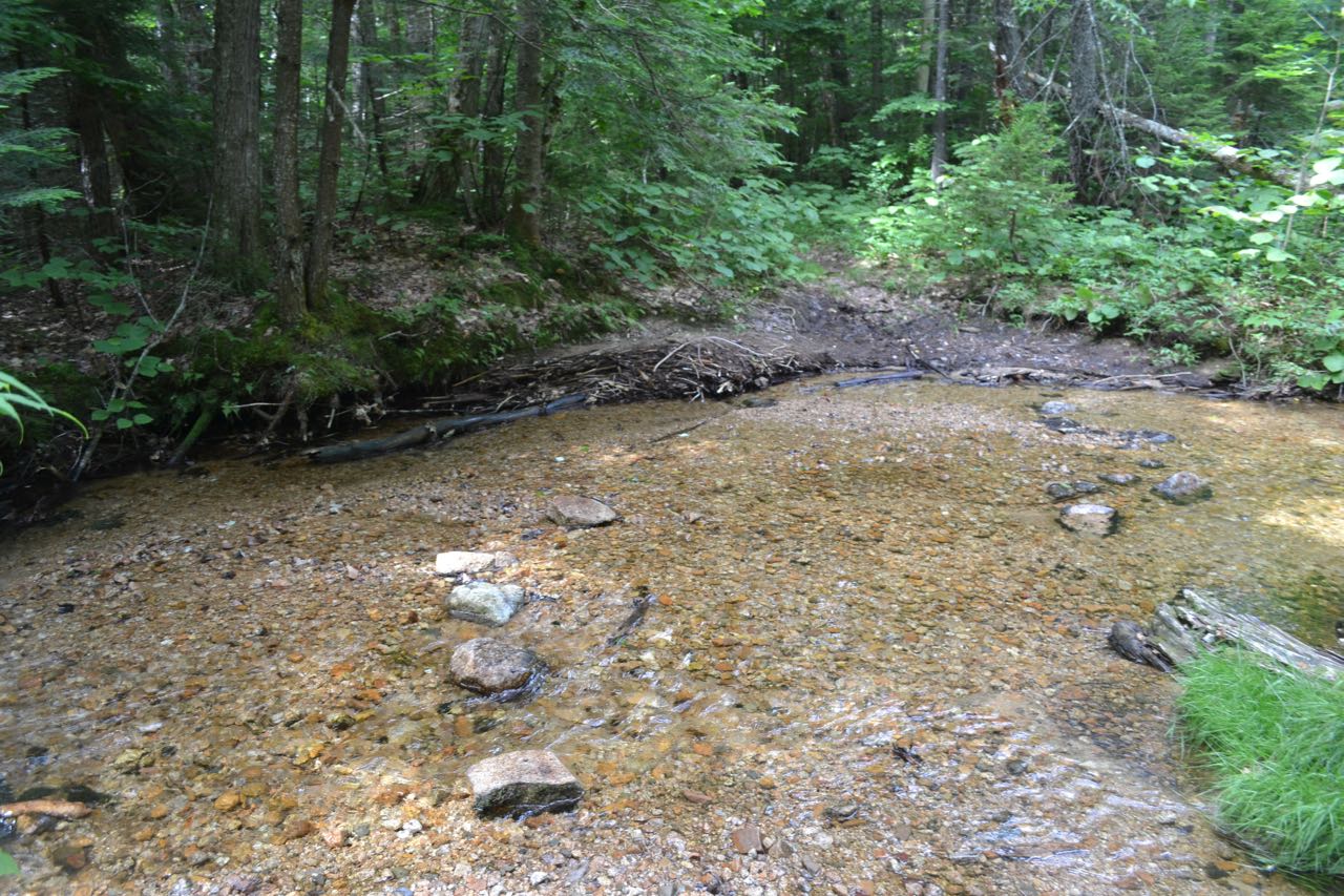
From the parking area, pass by the gate and follow Oliverian Brook Trail as it makes a quick zig-zag, first into the woods to the left, then right to begin its journey into the valley of Oliverian Brook, following various abandoned corridors through pleasant woods. After 0.6 miles, you will meet with Oliverian Brook, to remain your companion for the next two and a half miles. Watch for a cross country ski trail junction on the right followed by a close pass to a marsh, at around 0.8 miles from the start. In another 0.3 miles, the trail abandons the straight course it had been following from a railroad grade and heads closer to Oliverian Brook. It comes closest to it after 0.2 miles and begins to climb noticeably. Some sections get very low on the brook bank. The trail continues along the brook for 0.4 miles, then passes the boundary sign for the Sandwich Range Wilderness. It continues for 0.2 miles, still close to the water, crossing two rocky streams across the slope, and comes to a trail junction. Bear left to stay on Oliverian Brook Trail as Passaconaway Cutoff goes to the right. This is the start of the loop over Square Ledge, so you will return on the cutoff. The loop is optimal in the clockwise direction because you will climb the steeps below Square Ledge and descend the easier pitches on the side opposite the cliff. At this point, the trail is still very low in the valley, about 1500'. Around 1000 vertical feet remain to the ledge. The trail continues along its mostly flat gradient in proximity to the brook (now only half as large because you are upstream of a major tributary on the other side), following a re-routed section in one place. In 0.3 miles from the trail junction, you must cross another side stream of the brook on decent rocks. Beyond here, the trail actually climbs again, then approaches the main brook, crossing it in half a mile past the side stream. This particular crossing is notable because it is located in a very sandy, shallow area with only small stepping stones. Thus, it is mostly safe, but would be impossible to get across without removing shoes during high water. Now, for the next 0.6 miles, the trail follows a course further away from the brook. During this section, the trail becomes narrower and crosses one small stream. At the end of this section, you will reach a junction with the Square Ledge Branch Trail.
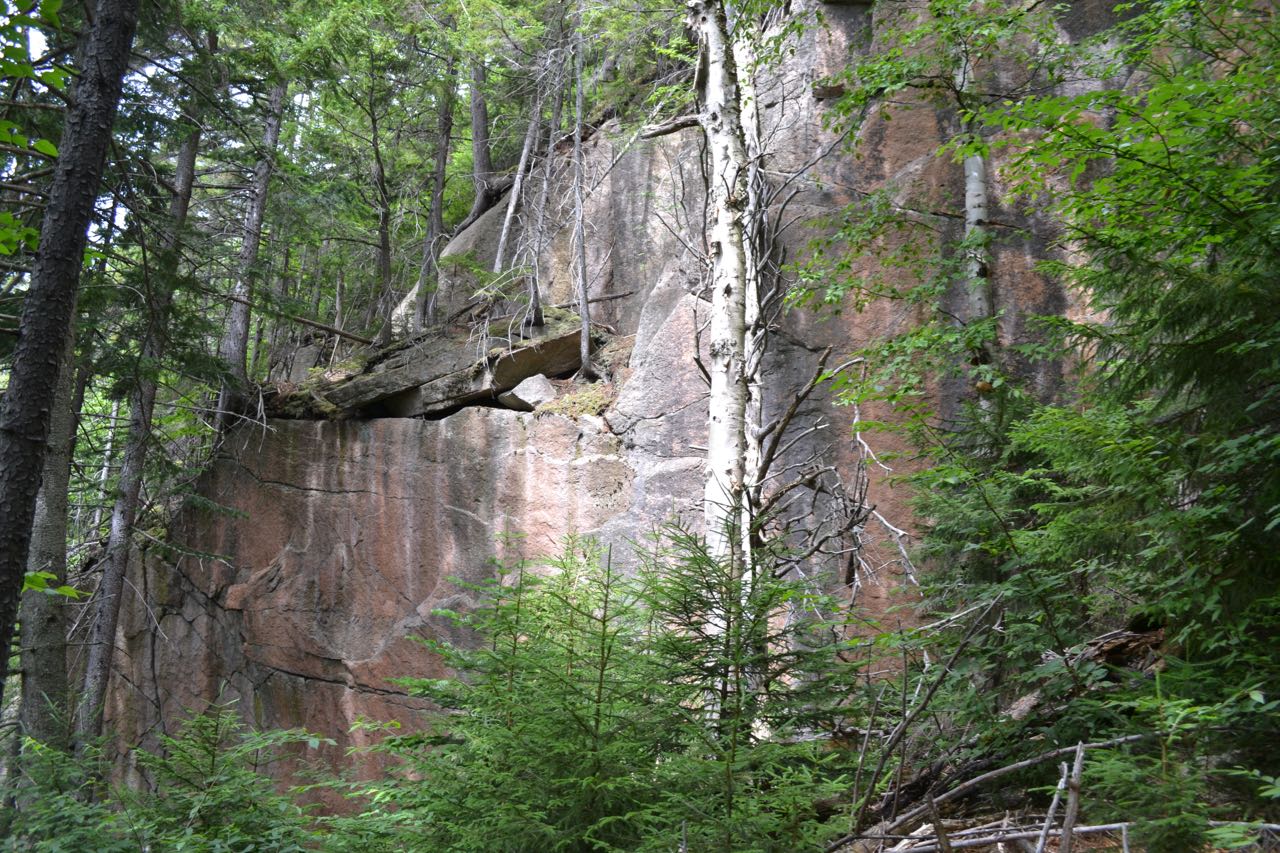
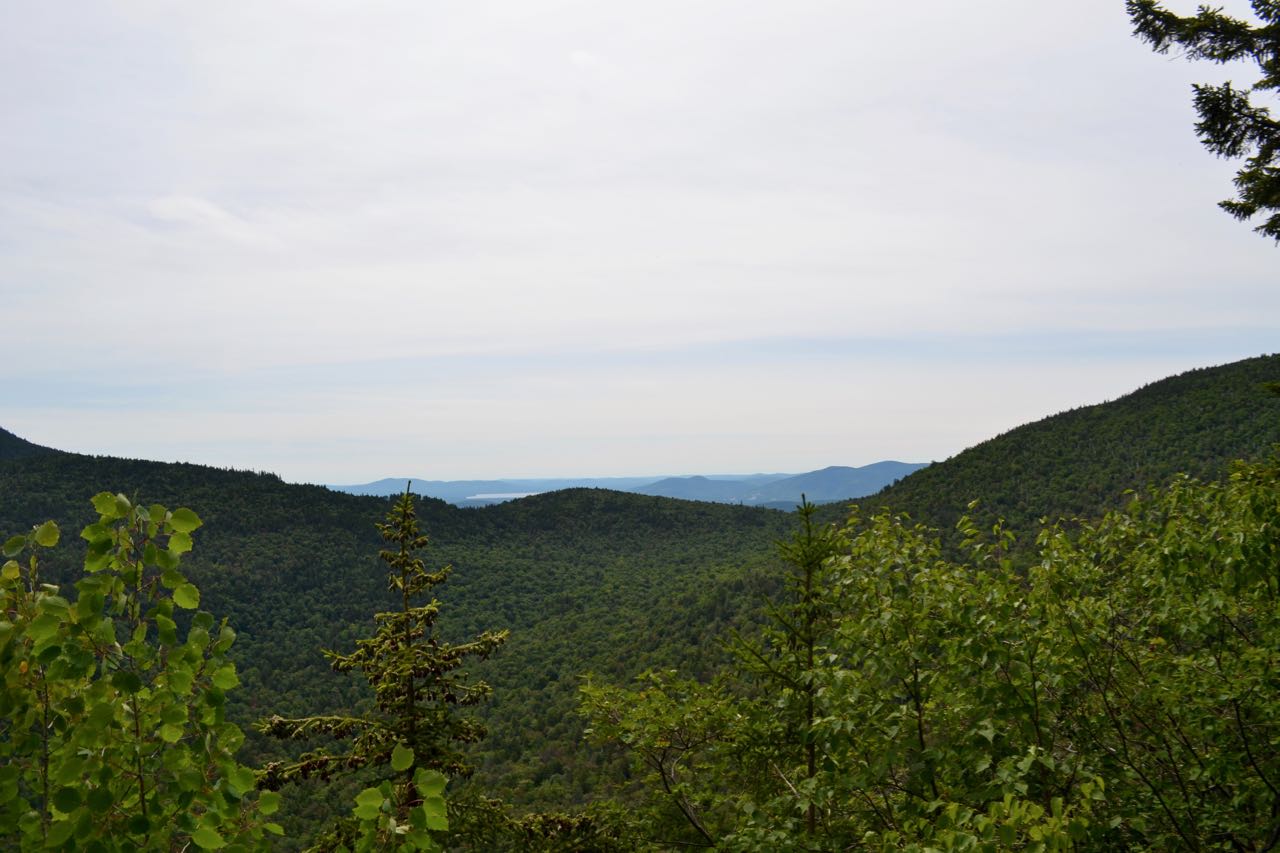
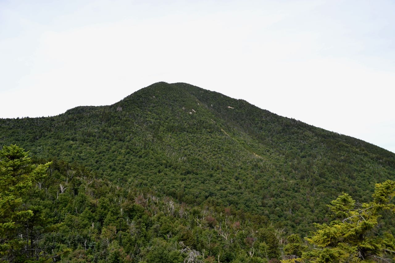
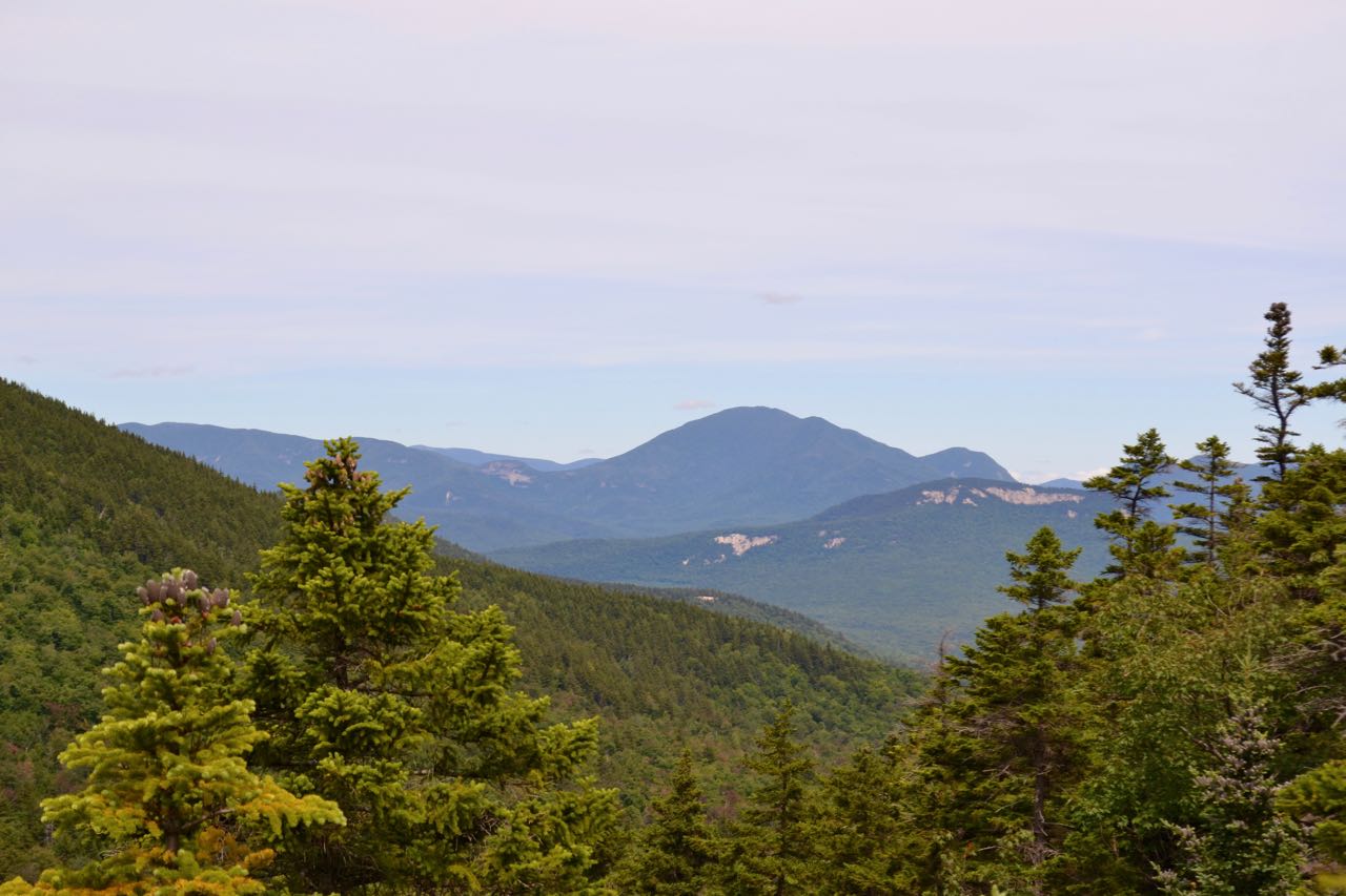
Turn right onto this trail and cross the Oliverian Brook for the second and last time - this crossing is much easier than the first. Now leaving the leisurely brook valley, you finally make the first serious ascent of the loop, starting from 600 feet below Square Ledge. A moderate incline of half a mile leads you to the next trail junction, with Square Ledge Trail. Turn right and follow this trail across the small Square Ledge Brook and into a more open forest. You will soon see the boulders around in the woods as the trail becomes rockier after a left turn to head toward the ledge. In the next half mile from the junction, the trail quickly rises to the base of some cliffs and becomes extremely steep for a short distance. Enjoy looking around at the impressive terrain as you climb over some steep scrambles. At the top of this section, look for an unmarked path on the right leading out to the main viewpoint on Square Ledge (the main trail turns left at this point). Admire the view from a safe distance; the outlook is surprisingly close to the edge. From this minor forest outlook, you can look at neighboring Mt. Paugus and Paugus Pass; beyond Paugus Pass you can see a bit of the Lakes Region. Beyond the viewpoint, the trail climbs moderately, passing an opening where you can see up to the higher ridges of Mt. Passaconaway, then makes a quick steep climb to the true summit of the ledge in just 0.1 miles. Watch carefully at this point and you can find a nice lookout in a hidden area. As the trail reaches its highpoint and bears right to descend along a rock wall, look for an overgrown path leading straight ahead. Follow this up to an open ledge to see views of Mt. Passaconaway towering above, and a few distant mountains, including Mt. Carrigain and Green's Cliff, seen over the valley on the west side of Square Ledge.
Continue on the main trail to descend Square Ledge. In 0.1 miles, you cross the bottom of the ridge connecting Square Ledge to the ridges of Mt. Passaconaway and see how insignificant its summit is. In the next 0.2 miles, the trail climbs briefly, then drops to the junction with Passaconaway Cutoff. This is the route you will use to close the loop, but first, turn left, staying on Square Ledge Trail, and climb for 0.3 miles. This detour will take you to the base of an open landslide, right on the side of the trail. Scramble up this slide to see better views to the north, including the Moat Range and Mt. Washington. Once you've finished enjoying the last exciting feature of the loop, head back down the Square Ledge Trail the way you came, passing by the route coming off Square Ledge to stay straight onto Passaconaway Cutoff. After descending over the last bit of rocky terrain, the trail eases and descends gently, slowly approaching the west branch of Oliverian Brook. It finally meets and crosses the brook in just over a mile. Beyond this, it is an easy half mile back to the junction with Oliverian Brook Trail, where you can return the way you came.
Printable directions page